

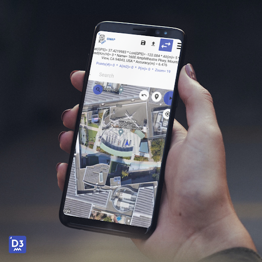
Features GPS Topography
Download the top GPS topography app for Android for freeTransform your device into an effective and lightweight tool for accurately measuring land areas without requiring an internet connection!---Key Features:- Swift capture of points, lines, or polygons using Google Maps or inputting field measurement data- Precise calculation of UTM coordinates, errors, corrections (using the Pennsylvania method), polygon perimeter, and area employing recognized civil engineering practices- Generate DXF files-No ads---Data Export: export your data into PDFs with detailed reports, TXT files for import into other programs, and DXF files for easy printing via CAD software---Advanced Functionalities:- Easily store and load projects- Export polygons to CSV files for convenient handling- Clear instructions for utilizing the GPS and survey screens, simplifying data capture and generationMake your topography work more efficient, saving valuable time with our intuitive tool!
Social Features
Connect and share with friends and the community.
Fitness Tracking
Track your workouts and monitor your health metrics.
Travel Features
Plan and manage your travels with ease.
See the GPS Topography in Action

Get the App Today
Available for Android 8.0 and above